RPAS WILCO
Flight Planning App
The all-in-one platform trusted by Canadian drone operators for flight planning, compliance management, and real-time airspace intelligence powered by official NAV CANADA data.
RPAS WILCO Mobile App

Trusted by industry leaders across Canada
Everything You Need to Fly Legally
Built specifically for Canadian drone regulations. Stay compliant without the complexity.
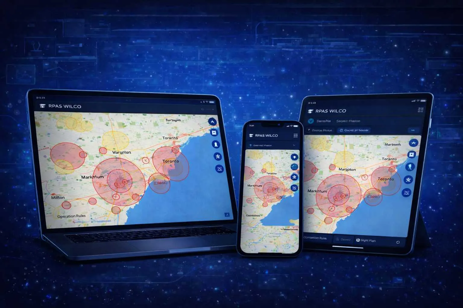
Interactive Flight Planning
Plan missions with our powerful map interface. Draw flight paths, set waypoints, and visualize your entire operation.
Official NAV CANADA Data
The leading drone platform with official NAV CANADA aeronautical data distribution. Access aerodromes, airspace, VFR charts, and CFS data.
Site Survey in < 2 Minutes
Generate comprehensive site surveys quickly with official data, population density maps, and all required documentation.
Fleet Management
Track maintenance schedules, flight hours, and certifications for all your drones in one place.
Population Density Maps
Access detailed population density data to plan safe flight operations and understand your operating environment.
Compliance Reporting
Automatic flight logs, pilot records, and audit-ready documentation.
Earn Wilcoin, Unlock Rewards
Every flight, mission, and milestone earns you Wilcoin — our in-app currency you can redeem for upgrades, perks, and exclusive gear.

Earn
Complete missions, file site surveys, refer fellow pilots, and maintain daily streaks to stack Wilcoin.
Spend
Redeem for Pro upgrades, partner discounts, premium features, and exclusive RPAS WILCO gear.
Grow
Higher tiers unlock bigger rewards, leaderboard visibility, and exclusive perks for top pilots.
How It Works
Get from planning to flying in three simple steps.
Plan Your Mission
Use our interactive map to draw your flight area, set altitude limits, and check airspace restrictions.
Generate Documents
Automatically create site surveys and all required compliance documentation in under 2 minutes.
Fly With Confidence
Execute your mission with official NAV CANADA data, airspace alerts, and automatic flight logging.
Simple Pricing
Choose the plan that fits your needs.
Ready to Run Missions in the RPAS WILCO App?
Join 50,000+ pilots who trust RPAS WILCO for flight planning and compliance.
RPAS WILCO Mobile App
Trusted by 50,000+ drone pilots across Canada · Official NAV CANADA Data Distributor